Brewery Creek Guard Station
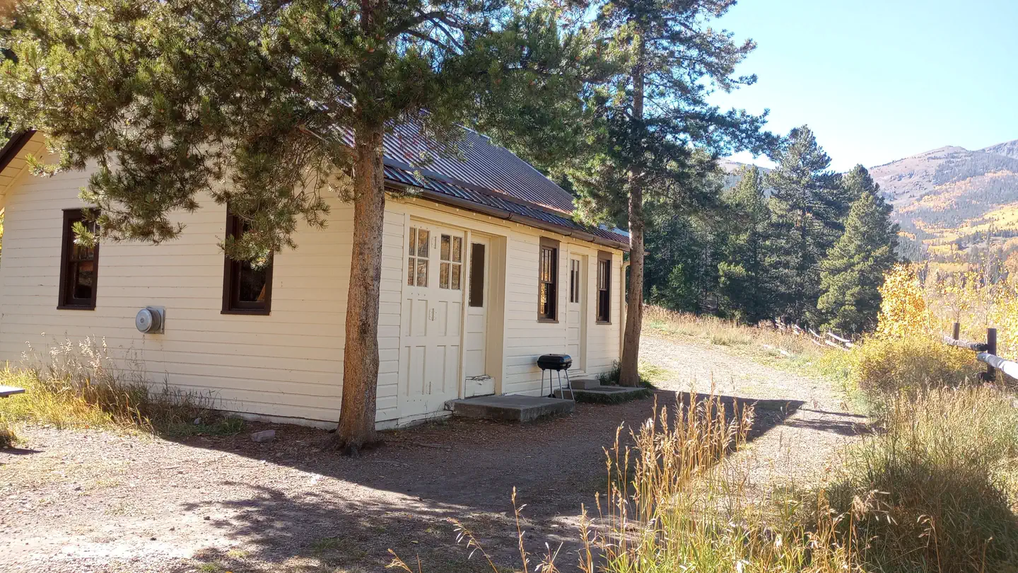
Brewery Creek Guard Station
About this campsite
Overview
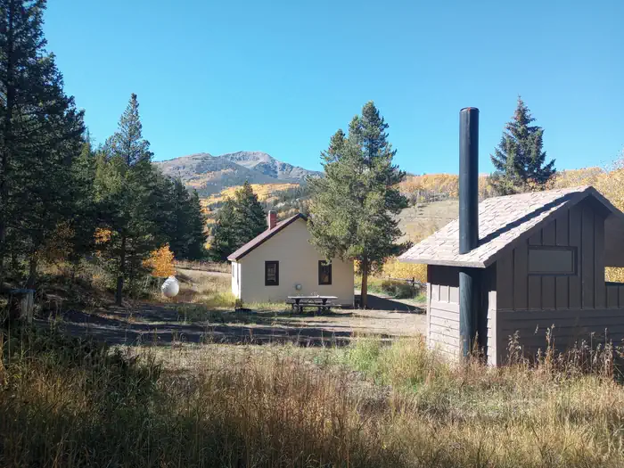
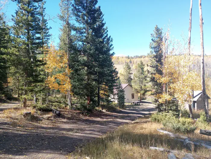
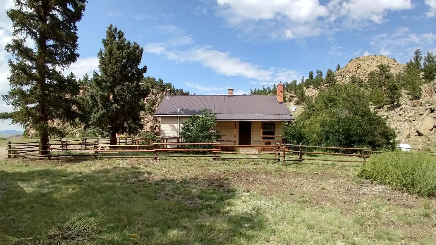
Brewery Creek Guard Station is situated at an elevation of 9,500 feet in a densely wooded aspen grove overlooking Brewery Creek. The cabin is a few miles south of the Continental Divide on the northern end of the San Luis Valley in the Rio Grande National Forest.Built in 1935, the two room cabin was originally used by a forest ranger who oversaw the Poncha and Bonanza Districts of what was then called the Cochetopa National Forest.
Today the cabin is a comfortable getaway for guests seeking relaxation and recreation in south central Colorado.
Recreation
The area offers many opportunities for hiking and off-road vehicle adventures in summer, hunting in the fall, and cross country skiing and snowmobiling in the winter.Several hiking trails are in close proximity to the cabin, including several leading up to Antora and Antora Meadows.
Facilities
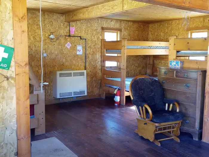
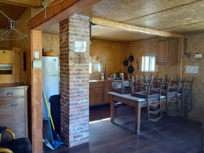
The cabin is furnished with three bunkbeds (the top is a single bed, the bottom is a fold-out futon couch that sleeps two) and can accommodate up to nine people.The cabin has stove, refrigerator and heater, all powered with propane. The kitchen is equipped with cooking utensils and some pots and pans. Picnic tables, a fire pit and a outdoor vault toilet are also on site.
The guard station does not have electricity, though water is available from an outside hand pump. Water is also available at the Saguache Ranger District Office during business hours from May through November.
Although the cabin has most amenities, guests do need to provide their own food, sleeping bags, linens, towels, dish soap, matches, cooking gear, first aid kit, toilet paper and garbage bags. It is recommended that guests bring an additional light source in case of emergencies.
Natural Features
The cabin offers wonderful views of Antora Peak (13,266 feet) and Windy Point (12,129 feet) towering over the valley. Active beaver dams occupy the nearby creek just below the cabin, where anglers can cast a line into the frigid waters. Elk, deer, and other wildlife are often seen in meadows adjacent to the cabin.Nearby Attractions
Brewery Creek Guard Station is located 2 miles from Bonanza, a historical silver mining town that was booming in the 1880's. Today visitors to Bonanza can see old mines, historical buildings, and old time mining equipment as they follow the Bonanza Mines Off-Highway Vehicle Tour. Maps for the Bonanza Off-Highway Vehicle Tour are available at the Saguache Ranger Station.Location
BREWERY CREEK GUARD STATION•CO
Common questions about BREWERY CREEK GUARD STATION
Can you book BREWERY CREEK GUARD STATION online?
We hold no online booking link for BREWERY CREEK GUARD STATION, so it is not bookable through this page. Many parks and showgrounds still require a booking, so contact the operator before you go. Their website or phone number is the fastest way to confirm a site.
Where is BREWERY CREEK GUARD STATION?
BREWERY CREEK GUARD STATION sits in CO. The map on this page shows the exact spot, and the coordinates travel straight into your navigation app. Check road conditions before you set out if you are towing, since access tracks can change with the weather.
Nearby Campsites
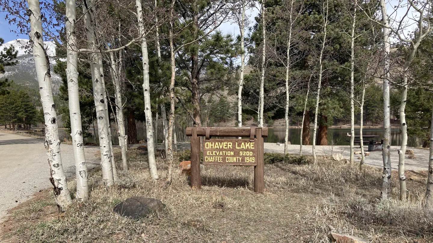 15.7 km away
CO
OHAVER LAKE
Overview The Forest Service wants your opinion on reserving sites at O’Haver Lake Campground. Please take a moment to fill out a brief survey at: https://forms.office.com/g/zFknf0tZbS O'Haver Lake Campground sits at an elevation of 9,200 feet, with ponderosa pines and aspen. It is located on the shores of O'Haver Lake. This facility has 31 sites and is a very popular destination that is often full on the weekends. "First come, first served" does not necessarily mean that the site will be available when you get there. Someone may get there before you. This is a popular campground and is normally full starting on Friday, sometimes as early as Thursday, so plan accordingly. Recreation There is an accessible fishing pier and non-motorized watercraft can be used to seek rainbow and brook trout on O'Haver Lake. If using non-motorized watercraft please be courteous to those who are fishing. Facilities Vault toilets and trash collection and campground host are provided. Firewood is sold on site. Sites #1-5, 7 ,13,21,23 and 24 are first-come, first-served, "Walk-up" sites. All other sites are reservable. Site #6 is used by the host from mid-May through September. After that time it is available as a "walk-up", first-come, first-served site. Natural Features This area attracts many campers for fishing, bird watching and canoeing on the calm, pleasant lake. Ponderosa pines provide a fresh vanilla scent in the mountain air and aspens please visitors with golden foliage displays in autumn. Contact Info For facility specific information, please call (661) 702-1420. Nearby Attractions The historic Denver and Rio Grande railroad grade traveled from Salida, southwest to the summit of Marshall Pass. The grade travels along County Road 200 above O'Haver Lake. This is a very popular mountain biking route with cyclists traveling from Monarch Pass to Marshall Pass on the Crest trail and then traveling down the railroad grade into Poncha Springs. Silver Creek, Starvation Creek, Poncha Creek and the Rainbow Trail are also nearby trails. Shirley Site is located off of Highway 285 and County Road 200 just below Poncha Pass. Shirley got its name during the 1880's when it served as a busy construction camp for men building the Denver and Rio Grande rail line over Marshall Pass to the ore-rich mines in Gunnison. By summer of 1881, Shirley boasted 14 large business tents, most of which were saloons and dance halls. Little remains of the town of Shirley except the coal stained railbed that can be seen just north of the Shirley site parking area. Shirley Site is a popular staging area for OHV riders and mountain bikers during the summer months and snowmobilers during winter. Charges & Cancellations Cancellations Individual Campsites: Cancellations up to 2 days before a reservation start date incur a $10.00 cancellation fee. A visitor who cancels a reservation the day before or on the day of arrival will pay a $10.00 service fee AND forfeit the first night's use fee including tax and applicable add-on for a campsite. Cancellations for a one-night reservation will forfeit the entire amount paid and will not be subject to an additional service fee. No-Shows A no-show visitor is one who does not arrive at a campground and does not cancel the reservation by check-out time on the day after the scheduled arrival date. Staff will hold a campsite until check-out time on the day following the arrival date. No-shows are assessed $20.00 service fee and forfeit the first night's rate, taxes and applicable add-on for a campsite. Refunds Visitors may submit a refund request through their Recreation.gov profile within 7 days of the end date of their reservation. Refunds will not be issued after the 7 days has ended
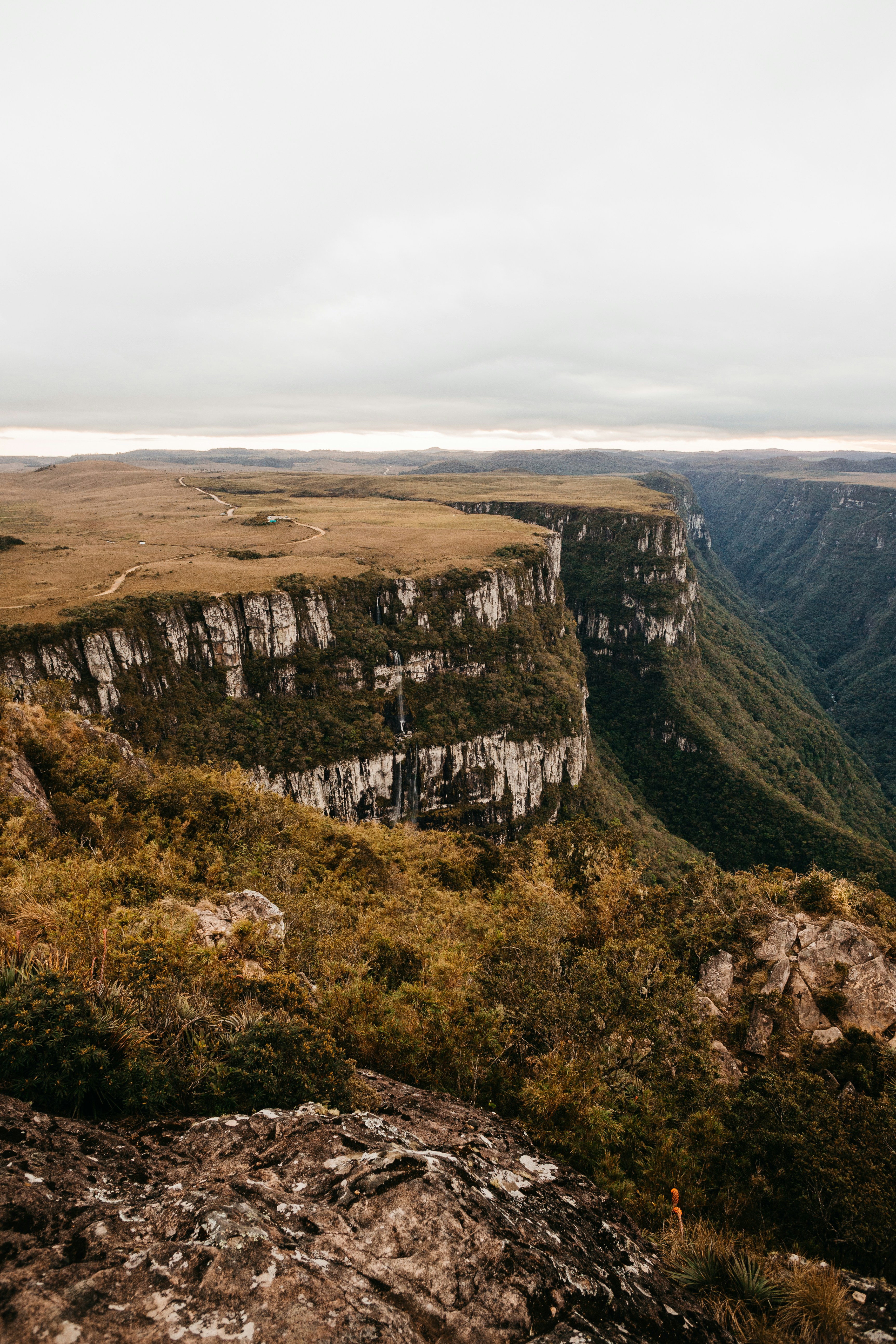 17.7 km away
CO
Clayton Camp
Campground: Clayton Camp.
20.4 km awayCO
San Luis Valley Campground
Campground: San Luis Valley Campground.
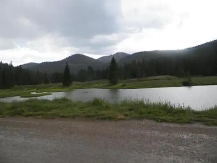 28.8 km away
CO
MONARCH PARK
Overview After being closed the past couple of years for renovations, look for Monarch Park to reopen in late summer 2026. Monarch Park is nestled at the base of Monarch Ridge, a short drive north of Monarch Pass on Highway 50. Some campsites at the family-friendly destination are located on the banks of the South Fork Arkansas River, while others lie along a creek. Popular activities in the area include hiking the Colorado/Continental DivideTrail and fishing. Beaver ponds near the entrance to the campground make a great fishing spot for families with young children. Monarch Pass is a high mountain pass along the southern part of Colorado's Sawatch Range. The pass crosses the Continental Divide at an altitude of 11,312 feet. Recreation Popular trails near Monarch Park include Waterdog Lakes, the Monarch Crest Trail and the Hunt and Boss Lakes trails. Wildflowers are abundant on these trails in late summer. The river and nearby ponds provide quality fishing for all ages. Brook trout is the most likely reward for fishing efforts. Facilities Drinking water from a hand pump is available. Vault toilets are available and one is wheelchair accessible. All sites come with picnic tables and campfire rings. Firewood is sold onsite. No electrical or sewer hookups are available. The nearest RV dump station is at the Poncha Springs Visitor Center located at 7001 Highway 285 (near the intersection of US Highway 285 and US Highway 50) in Poncha Springs, CO. Natural Features The elevation is 10,500 feet, and visitors should plan for cool nighttime temperatures. Some campsites are located near the south fork of the Little Arkansas River. Contact Info For facility specific information, please call (661) 702-1420. Nearby Attractions The city of Salida is only a short drive away where visitors can enjoy unique restaurants, shops, art galleries, and antique shops. The area boasts more than 100 miles of Arkansas River to raft, fish, float or kayak, as well as fifteen 14,000 ft. mountains. Visitors can choose from recreational activities like hiking, biking, ATV/UTV riding, kayaking, rafting, fishing, horseback riding, zip lining, and swimming. Charges & Cancellations Cancellations Individual Campsites: Cancellations up to 2 days before a reservation start date incur a $10.00 cancellation fee. A visitor who cancels a reservation the day before or on the day of arrival will pay a $10.00 service fee AND forfeit the first night's use fee including tax and applicable add-on for a campsite. Cancellations for a one-night reservation will forfeit the entire amount paid and will not be subject to an additional service fee. No-Shows A no-show visitor is one who does not arrive at a campground and does not cancel the reservation by check-out time on the day after the scheduled arrival date. Staff will hold a campsite until check-out time on the day following the arrival date. No-shows are assessed $20.00 service fee and forfeit the first night's rate, taxes and applicable add-on for a campsite. Refunds Visitors may submit a refund request through their Recreation.gov profile within 7 days of the end date of their reservation. Refunds will not be issued after the 7 days has ended. Refunds for debit or credit card payments will be issued as a credit to the original bank or credit card used to pay. For check or cash purchases, Recreation.gov will mail a Treasury check for refunds of cash, check, or money order payments to the address associated with the reservation. Treasury check refunds may take up to 6-8 weeks to arrive. In the event of an emergency closure, the Recreation.gov team or facility manager will refund all fees and will attempt to notify you using the contact information within the Recreation.gov visitor profile.
 30.2 km away
CO
UPPER CROSSING GUARD STATION
Overview Upper Crossing Guard Station is located at an elevation of 8,400 feet, along a scenic byway near the Continental Divide, offering visitors a comfortable lodging experience in a remote setting in Rio Grande National Forest. This guard station is the original headquarters of the old Cochetopa National Forest that existed for only a few years during the early part of the last century. Today, guests to the guard station will find plenty of opportunities for relaxation and recreation in south central Colorado. Recreation The area offers many opportunities for hiking in summer, hunting in the fall and cross country skiing and snowmobiling in the winter. The cabin sits at the confluence of two creeks and offers visitors excellent fishing for rainbow, cutthroat, brown and brook trout right out the front door. Hiking opportunities are in close proximity to the cabin, extending out to nearby wilderness and other public lands. Facilities Upper Crossing Guard Station has all the amenities of a standard home, including electricity, heat and inside running water. It is furnished with three bunk beds, with twin beds on the top and fold-out full beds on the bottom, accommodating up to nine people. The cabin has electric lights, propane heater and wood burning stove. The living area has a table and chairs, couch and other furniture. The kitchen is equipped with a refrigerator, stove, hot water, some cooking utensils and some pots and pans. A picnic table, campfire grill and horseshoe pit are also on-site. Although the cabin has most amenities, guests do need to provide their own food, sleeping bags, linens, towels, dish soap, matches, cooking gear, first aid kit, toilet paper and garbage bags. It is recommended that guests bring an additional light source in case of emergencies. Natural Features Upper Crossing Guard Station provides a remote setting that is easily accessible year-round via CO Highway 114. The brief dirt road leading to the cabin is actually the old stagecoach route, complete with historic graffiti that served as billboards advertising goods and services at the stagecoach stops. Views from the cabin include portions of the Continental Divide and unspoiled surrounding countryside, showcasing high mountain peaks, diverse forests, streams and lakes in addition to some of Colorado's most scenic working ranches. Historically, Ute Indians traveled through this area and found it favorable for living in the San Luis Valley.
 Britz HiTopCampervan
 Maui UltimaCampervan
 Jucy CoasterCampervan
Hitting the road? Rent the rig, not just the gear.
Compare live prices across Britz, Maui, Apollo, Jucy & more — campervans and motorhomes, one-way hires included.
Compare & bookPlan your visit
Save it, check the weather, map your route
Nearby Fuel
Campsite Explorer
Find Your Next Campsite
Share Your Experience
Help fellow campers by sharing your photos and reviews.
Own This Campsite?
Claim your listing to manage information, respond to reviews, and update details.