Santa Rosa Island
Santa Rosa Island
About this campsite
Overview
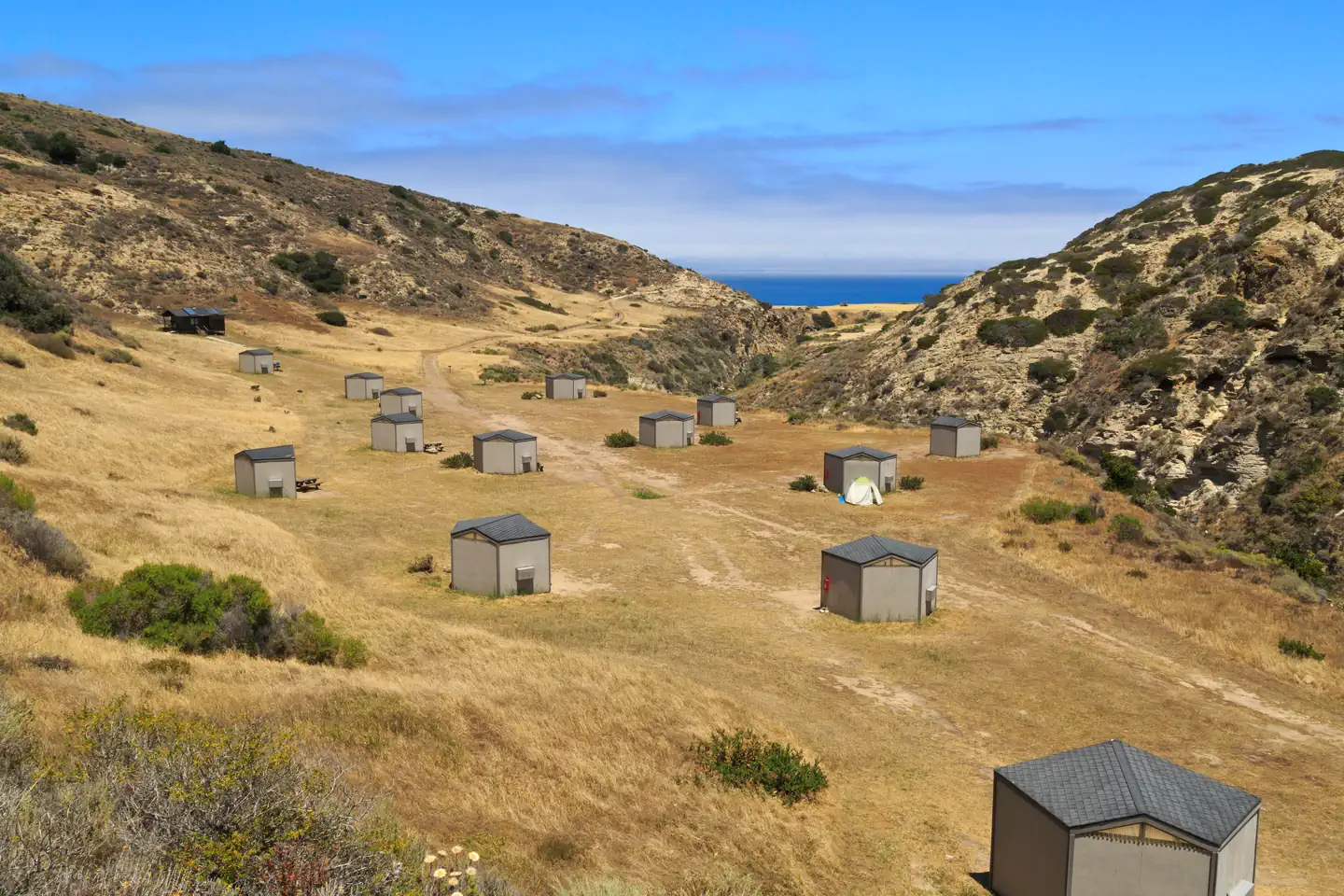
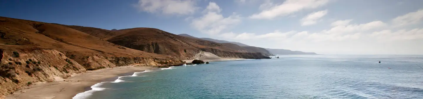
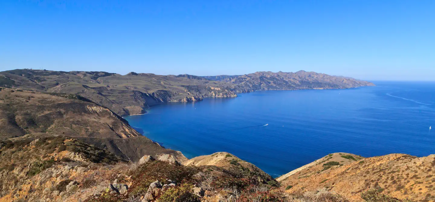
Tucked away in a canyon to protect visitors from strong northwest winds, Water Canyon Campground offers exceptional island views, access to spectacular hiking opportunities and a nearby white sand beach.
Located 40 nautical miles from the Channel Islands National Park visitor center in Ventura, Santa Rosa is the second largest island in California at approximately 53,000 acres in size. The island landforms support a diverse array of plant and animal species including six plant species found nowhere on earth but Santa Rosa Island. The island also hosts over 100 bird and three land mammal species, including the endemic island fox.
Recreation
Several trails and roads traverse the island, providing visitors with spectacular hiking opportunities, including the relatively flat route to Water Canyon Beach to the rugged, mountainous path to Black Mountain.
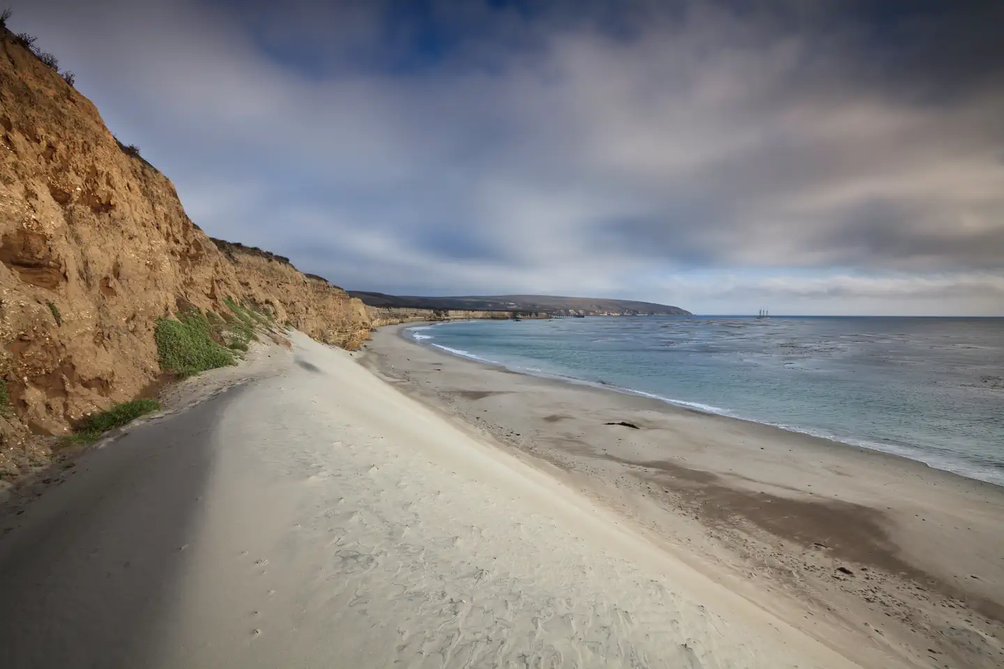
Due to the strong, persistent wind, swimming, snorkeling, diving and kayaking are limited and recommended for the experienced visitor only. Despite the wind, Santa Rosa Island offers exceptional beach walking on white sand beaches. Access to one of the best beaches, Water Canyon Beach, is just over a mile from the pier in Bechers Bay and just down canyon from the campground. Beach access is also available near the pier.
No fishing is allowed within the marine reserves located around the island. Fishing is allowed outside of these areas.
For more information about recreational activities in the park, visit https://www.nps.gov/chis/planyourvisit/index.htm.
Facilities
Primitive camping is available at Water Canyon Campground (15 sites; 5 persons per site). Picnic table, food storage box, windbreak (8' tall, 10' deep, 14' wide at front, 8' wide at back), restroom and water are provided. The campground is a flat 1.5-mile hike from the pier and a 0.25-mile from the airstrip and Water Canyon Beach. Due to the boat schedule, minimum stay is generally three days.
Natural Features
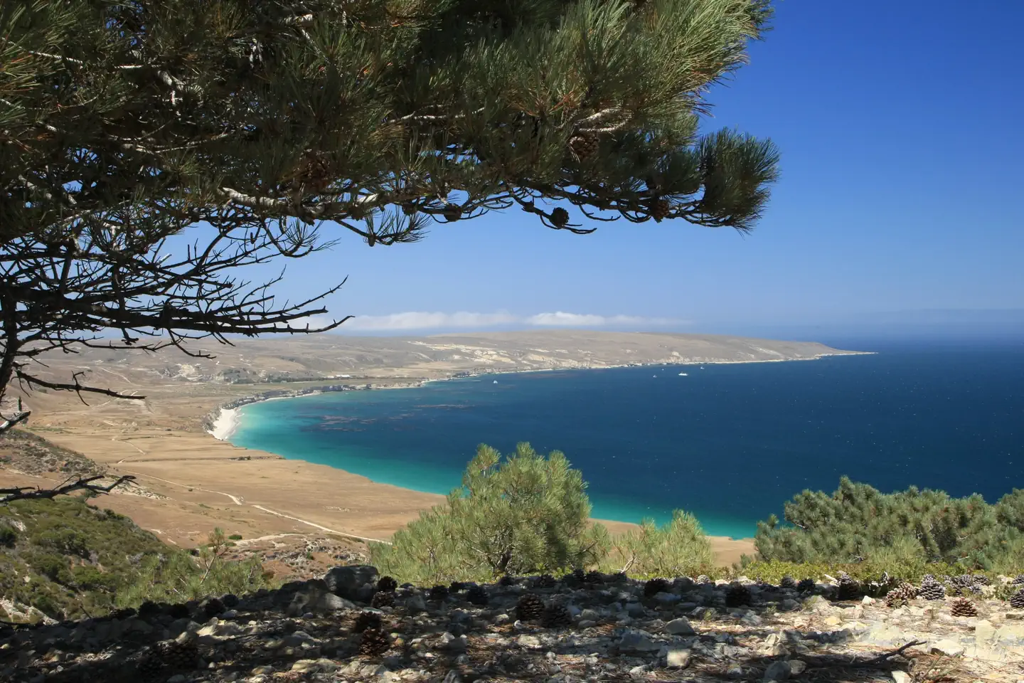
Santa Rosa has a landscape of remarkable contrasts. High mountains with deeply cut canyons give way to gently rolling grass-covered hills, extensive beaches and coastal wetlands. The altitude ranges from sea level to 1,589 feet.Nearby Attractions
Good tidepooling spots are located within Bechers Bay, including just east of the pier, the east end of Southeast Anchorage, and near East Point.
A short hike from the campground is the Santa Rosa Island Torrey pine grove. This pine is considered one of the rarest pines in the world-the last enduring members of a once widespread Pleistocene forest. Near the pier, visitors can see buildings and equipment of the historic Vail and Vickers ranch.
Access to a highly recommended beach, Water Canyon Beach, is just over a mile from the Bechers Bay pier. The sandy beach lies on the northeastern shore of the island. Bechers Bay is a destination in itself, with buildings and equipment at the historic Vail and Vickers ranch.
Location
SANTA ROSA ISLAND•CA
Weather Forecast
via Open-MeteoNearby Campsites
 4.1 km away
CA
SANTA ROSA ISLAND BACKCOUNTRY BEACH CAMPING
Overview Backcountry beach camping is available mid-August through December along Santa Rosa Island's extensive, beautiful, and undeveloped 55-mile coastline. This coastline is reminiscent of California in days gone by. The rocky coast and sandy beaches are much the same as the ones the Chumash Indians, Spanish explorers, and early ranchers may have known. This remote, fragile environment is critical for sea and shorebirds, marine mammals, and plant communities. In 1992, the National Park Service opened the island to backcountry beach camping in recognition of its rare wilderness values. As you explore these wild areas by kayak or on foot, please take responsibility to help us protect and preserve these delicate natural resources for future generations. The following information will help you enjoy your visit while leaving the smallest impact on the island. Warning : While backcountry camping is an incredible experience, it is not for the inexperienced backpacker or kayaker. Due to difficult weather, rugged terrain, and off-trail hiking, backcountry camping is an arduous endeavor and should be undertaken only by experienced, well-conditioned backpackers and kayakers. Less experienced visitors to the island should consider frontcountry camping at Santa Rosa Island Campground in Water Canyon, which also offers advance reservations with some amenities (e.g., pit toilet, picnic table, water). WAG Bags Required: Visitors are required to pack out human waste and toilet paper in the backcountry using "WAG" (human waste collection) bags. Visitors must bring there own bags which are available from outdoor suppliers. Backcountry Beach Camping Dates January 1 - August 14: Backcountry beach camping is CLOSED to protect pupping seals/sea lions and nesting seabirds. August 15 - September 15: Only East Point to South Point Beaches (Southeast Quadrant) are open to backcountry camping for boaters, kayakers, and backpackers. September 16 - December 31: Southeast, Southwest, and Northwest Quadrant beaches are open to backcountry camping. Beaches around Sandy Point, at Lobo Canyon, and Northeast Quadrant beaches (between Carrington Point and East Point) remain closed to camping. Recreation Boat and Airplane Drop Off Points. The park boat concessionaire, Island Packers, drops off and picks up kayakers and backpackers at the Bechers Bay pier. Campers should coordinate purchasing boat tickets in conjunction with making campground reservations. There is currently no park airline concessionaire, private landings on the airstrip near Water Canyon, or anywhere else on the island, is prohibited. Trail Conditions. Hiking to beach camping areas requires travel along rugged exposed mountainous roads, trails, and unmaintained routes often created by island animals. Expect high winds and sunny conditions with no shade or cover. Navigating beaches and bluffs may be possible depending on ocean conditions and commonly require hiking across drainages and badlands. It is recommended to carry tide charts when navigating the beaches, coasts and bluffs. Some road/trail intersections have signs, some do not. Most trails and routes do not get you directly to a beach camping area, but instead end above a marine terrace/bluff or on top of a canyon and you must find the safest way down to the beach. Maps. Please refer to topographical maps for more accurate mileage and to help with the following descriptions. It is recommended that all backcountry campers have both digital and physical maps. Backpackers should carry topographic maps (USGS 7.5 minute maps or the Trails Illustrated map of all the islands) and kayakers carry nautical charts before departing on their journey. Hiking and Kayaking Distances to Beach C
 28.3 km away
CA
SAN MIGUEL ISLAND
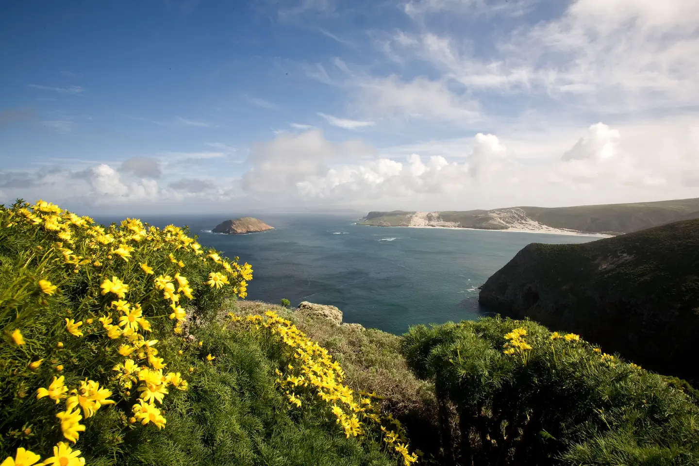
Overview Wind and weather constantly sweep across the North Pacific to batter the shores of this westernmost of all the islands. This extreme weather creates a harsh but profoundly beautiful environment. Although it can be challenging to reach the San Miguel Island Campground, it's always worth the effort. Perched on a plateau, the campground offers incredible island views and access to a variety of recreational activities and unique natural and cultural resources. Although a century's worth of sheep ranching and overgrazing caused scientists in 1875 to describe the island as "a barren lump of sand," with the grazing animals removed, vegetative recovery is in progress. Giant coreopsis, dudleya, locoweed, lupine, buckwheat, coastal sagebrush, and poppies are all recolonizing the island to their former extent, returning San Miguel to its more natural state. Also making a comeback, after years of hunting, are the thousands of pinnipeds (seals and sea lions) that breed, pup, and haul out on the island's 27 miles of isolated coastline. Other wildlife include a variety of landbirds, 13 nesting seabird species, and unique animals like the island fox and deer mouse. Both of these little creatures are endemics -- they are found only on the Channel Islands. In addition to the variety of natural resources, San Miguel hosts an array of cultural resources as well. The Chumash and their ancestors lived on San Miguel almost continuously for nearly 12,000 years. Juan Rodriguez Cabrillo and his men laid eyes on San Miguel Island in 1542 which is commemorated by a monument on the island. Other outstanding island resources that visitors may experience on San Miguel include the caliche forest (sand-castings of ancient vegetation), fossil bones of the Pleistocene pygmy mammoths that stood four to six feet at the shoulders, 150 years of ranching history and numerous shipwrecks. Recreation A permit (including liability waiver) is required to visit the island. If you are traveling to San Miguel Island with Island Packers, Channel Islands Aviation, or Truth Aquatics, they will provide the forms to you upon your reservation. Private boaters can obtain the forms at a self-registration station at the Nidever Canyon trailhead entry on San Miguel Island. Several trails traverse San Miguel Island providing visitors with spectacular hiking opportunities. While many parts of the island are closed to protect wildlife, fragile plants, and geological features, several areas are open for you to explore. Visitors may explore the two-mile-long Cuyler Harbor beach and one-mile-long trail to the ranger station on their own. To see other parts of the island, such as Point Bennett or the caliche forest, you must go with a ranger or volunteer. If arriving with a concessionaire, park staff are usually available to offer guided hikes. However, there is no guarantee that hikes will be offered to all locations. Visitors must coordinate with island staff upon arrival. All hikers must stay on the trails to protect fragile vegetation and for visitor safety. No off-trail hiking is allowed. Due to the strong, persistent wind, swimming, snorkeling, diving and kayaking are limited and recommended for the experienced visitor only. In addition, landing and beach access is only allowed at Cuyler Harbor. No fishing is allowed within the marine reserves located around the island. Fishing is allowed outside of these areas. For more information about recreational activities in the park, visit https://www.nps.gov/chis/planyourvisit/index.htm . Facilities A one mile, steep uphill hike from the boat landing in Cuyler Harbor to the 9-site campground is required. If you fly in, then its a short, flat 1/4 mile hike. Camping is primitive and campers must bring their own food, equipment and water. Pic
 33.9 km away
CA
Santa Cruz Island Prisoners Harbor
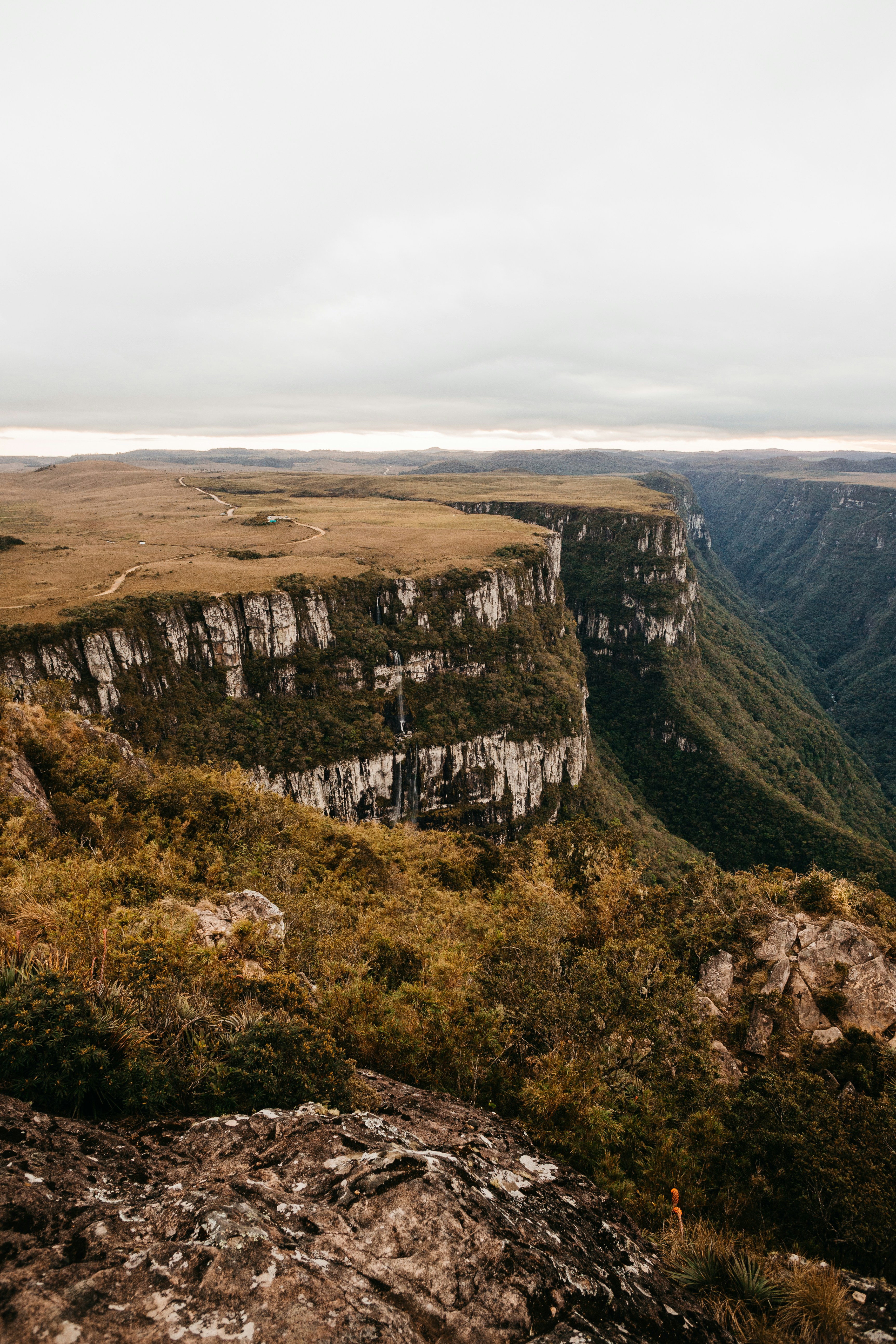
Overview The Prisoners Harbor Campground is located near the shoreline, and with a maximum capacity of 24 people, it offers a quieter experience than the larger campground at Scorpion. The campground is a short hike from the pier and is sheltered from harsh ocean winds. As you explore this area, please respect the property boundary and help protect and preserve these delicate resources for future generations. Santa Cruz Island, the largest of California’s Channel Islands, is one of the five islands that make up Channel Islands National Park. The island is rich in cultural history, magnificent landscapes, and unique flora and fauna. Native American peoples inhabited the island for over 10,000 years, and Europeans explored and ranched on the island for more than 150 years. More than 600 plant species, 140 land birds, 11 land mammals, and a variety of amphibians and reptiles call the island home. The island fox and island scrub‑jay are especially exciting finds, as they are unique to Santa Cruz Island and found nowhere else in the world. Recreation From Prisoners Harbor, the campground is only 0.3 miles from the pier. The road does follow a road which passes through a seasonal creek. While the campground has an accessible site and an accessible toilet, transportation to the campground requires use of a ladder and on an uneven road. This road is still used daily by vehicles, so please use caution while hiking along it. During winter and spring, visitors need to be prepared for a wet creek crossing at Canada del Puerto in Prisoner's Harbor. From Scorpion Anchorage, the campground is approximately 14 miles via the Navy Road. Beach access is at Prisoners Harbor. Recreational activities on Santa Cruz Island include hiking, swimming, snorkeling, diving, kayaking and wildlife/wildflower viewing. There are no services on the island, so all gear has to be brought to the island. For more information about recreational activities in the park, visit https://www.nps.gov/chis/planyourvisit/index.htm . Facilities The Prisoners Harbor Campground has six primitive campsites (four persons per site) and users must camp within these designated sites. Each site is 8 feet by 20 feet; smaller tents are appropriate for this location. A picnic table, food storage, and vault toilet are provided. Visitors are encouraged to pack as light as possible as they will need to carry all of their gear, food and water to the campsite. Water is not available. Access to the island is by Island Packers Cruises or by private boat. Natural Features The Prisoners Harbor Campground is nestled in a shaded oak grove. The largest of California's Channel Islands, Santa Cruz Island is one of the five islands that make up the Channel Islands National Park. The island is rich in cultural history, magnificent landscapes, and unique flora and fauna. Native American Indians inhabited the island for over 10,000 years and Europeans explored and ranched on the island for over 150 years. Over 600 plant species, 140 land birds, 11 land mammals and a handful of amphibians and reptiles call the island their home. The island fox and island scrub-jay are exciting finds, as they're unique to the island, found nowhere else in the world.
 34.0 km away
CA
Prisoners Harbor Campground
This campground is under construction and expected to open in 2026. Reservations required. Four-person limit per site. Each site contains a tent pad, picnic table, food storage box. One site is larger and has a ramp to the tent pad and an ADA-accessible picnic table. The path to this site from the pier is not ADA-accessible. There is an ADA-accessible vault toilet in the campground. No water is available. Distance from the pier to the campground is one-third of a mile.
 35.9 km away
CA
SANTA CRUZ ISLAND DEL NORTE BACKCOUNTRY
Overview For a truly remote getaway full of backpacking and breathtaking scenery, take a backcountry trip to Santa Cruz Island's Del Norte Campground. Del Norte is currently the only backcountry campground on Santa Cruz Island. The National Park Service opened this backcountry site in recognition of its rare wilderness values. As you explore these wild areas, please take the responsibility to help us protect and preserve these delicate natural resources for future generations. While backcountry camping is an incredible experience, it is not for the inexperienced backpacker. Due to difficult weather, rugged terrain, and off-trail hiking, backcountry camping is an arduous endeavor and should be undertaken only by experienced, well-conditioned backpackers. To reach this backcountry site, visitors will backpack along a historic ranch road/trail through a series of canyons and ridges, to a vista about 700 feet above sea level. This moderate to strenuous 3.5-mile hike from Prisoners Harbor travels through island oak woodlands and coastal sage scrub plant communities. Recreation From Prisoners Harbor, the shortest route to the Del Norte Campground is 3.5 miles via the Del Norte Trail. Follow the Navy Road out of Prisoners Harbor for 1.5 miles (600-foot elevation gain; strenuous). This gravel road is still used daily by vehicles, so please use caution while hiking along it. During winter and spring, visitors need to be prepared for a wet creek crossing at Canada del Puerto in Prisoner's Harbor. At the signed turn-off for Del Norte Trail, leave the gravel road and continue east (left) along the trail for 1.8 miles. The trail winds up and down two canyons (Cañada del Agua and Cañada del Muro)) to the signed junction with the Del Norte Road that leads .2 miles to the campground. The longer route (5 miles), which provides views of the south side of the island, follows the Navy Road as it climbs 1,200 feet over 4 miles and eventually reaches the junction with the Del Norte Road. At the signed junction, turn north (left) and descend 1 mile to the campground. From Scorpion Anchorage, Del Norte Campground is approximately 12 miles via the Navy Road. Beach access is at Prisoners Harbor. There is no access to the beach at Del Norte Campground. Recreational activities on Santa Cruz Island include hiking, swimming, snorkeling, diving, kayaking and wildlife/wildflower viewing. There are no services on the island, so all gear has to be brought to the island. Guided kayak trips and kayak rentals must be arranged before arriving on the island. For more information about recreational activities in the park, visit https://www.nps.gov/chis/planyourvisit/index.htm . Facilities The Del Norte Campground has four primitive campsites (four persons per site) and users must camp within these designated sites. A picnic table and pit-style toilet are provided (campers must bring their own toilet paper). Visitors are encouraged to pack as light as possible (backpacking style) as they will need to carry all of their gear, food and water to the campsite. Water is not available. Access to the island is by Island Packers Cruises or by private boat. Natural Features Del Norte is nestled in a shaded oak grove and provides scenic views of the island's pristine coastline. The largest of California's Channel Islands, Santa Cruz Island is one of the five islands that make up the Channel Islands National Park. The island is rich in cultural history, magnificent landscapes, and unique flora and fauna. Native American Indians inhabited the island for over 10,000 years and Europeans explored and ranched on the island for over 150 years. Over 600 plant species, 140 land birds, 11 land mammals and a handful of amphibians and reptiles call the island their home. The island fox and island scrub-jay are exciting finds, as they're unique to the island, found
 Britz HiTopCampervan
 Maui UltimaCampervan
 Jucy CoasterCampervan
Hitting the road? Rent the rig, not just the gear.
Compare live prices across Britz, Maui, Apollo, Jucy & more — campervans and motorhomes, one-way hires included.
Compare & bookPlan your visit
Save it, check the weather, map your route
Nearby Fuel
Campsite Explorer
Find Your Next Campsite
Share Your Experience
Help fellow campers by sharing your photos and reviews.
Own This Campsite?
Claim your listing to manage information, respond to reviews, and update details.
SANTA ROSA ISLAND