Lund Park Campground
Lund Park Campground
About this campsite
Overview
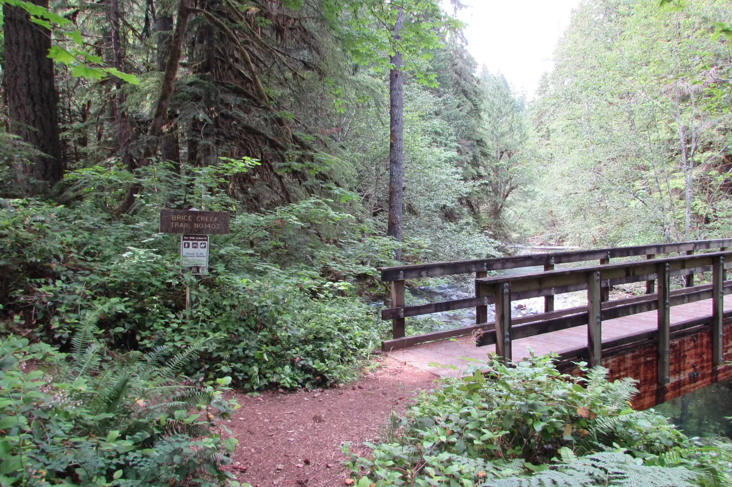
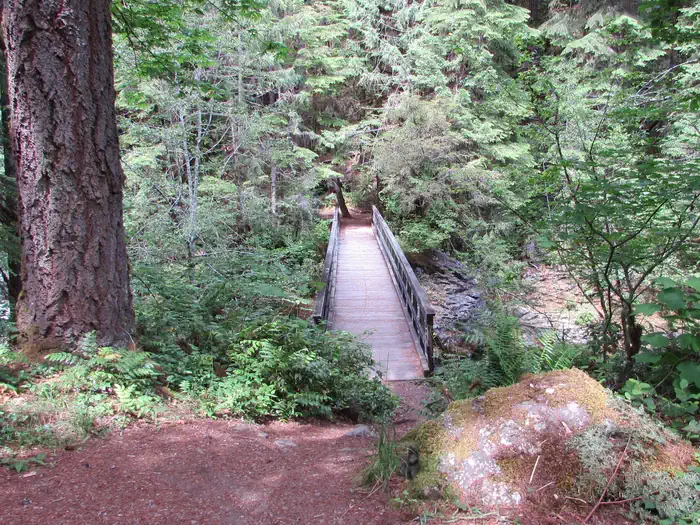
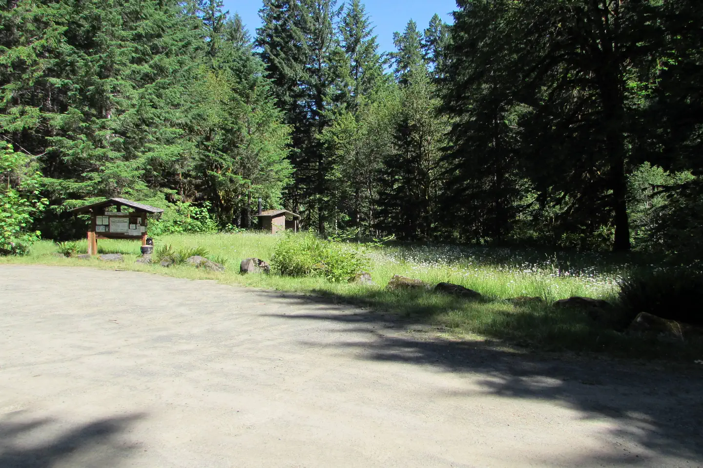
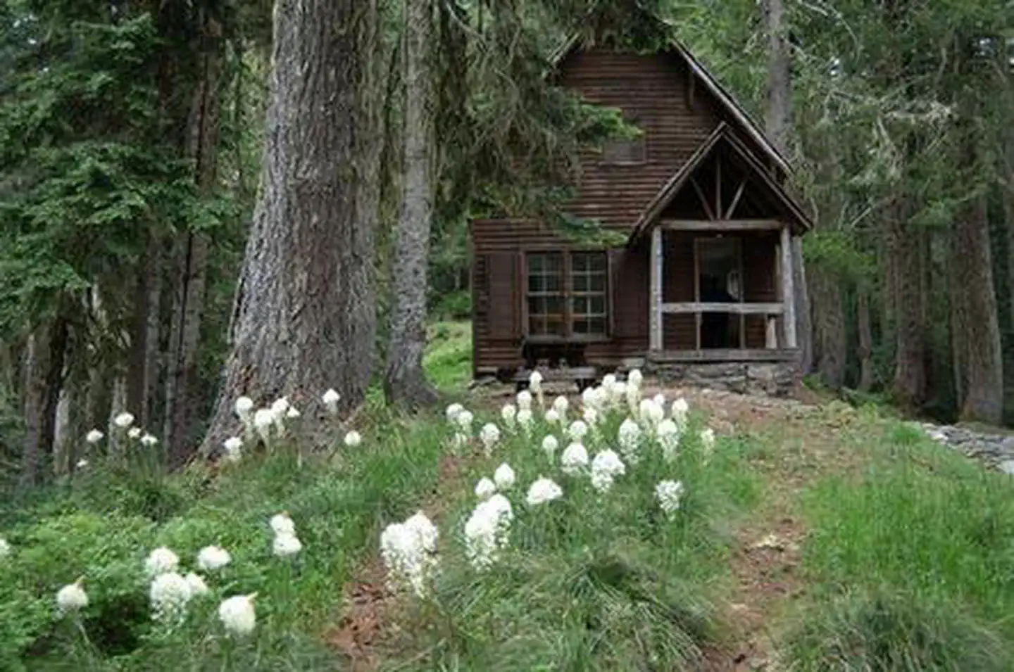
Nestled in the cool, quiet forest beside crystal clear Brice Creek, Lund Park Campground is the perfect place for slow mornings drinking coffee, exciting days exploring Brice Creek Trail across the bridge, and cozy nights being lulled to sleep by the sounds of the creek. With numerous hiking trails nearby and the scenic views along Brice Creek, Lund Park Campground makes an excellent base camp for local adventures.
Lund Park Campground also offers its rich history to visitors. During the early 1900s, the campground was once a stopover for miners traveling from Cottage Grove to the Bohemia Mines. Lund Park used to have a post office, hotel, dam, powerhouse, and several other buildings. Most of the structures have since been reclaimed by the forest, but near campsite one you can still see the remains of a concrete foundation beneath a thriving layer of moss and lichen.
Recreation
There are several wonderful hiking trails near Lund Park Campground.
Brice Creek Trail: 5.7 miles - On the west side of the campground, cross a trail bridge to the north side of Brice Creek and follow the trail. Lund Park Campground sits about 3 miles from the West Brice Trailhead and about 2 miles from the East Brice Trailhead. Brice Creek Trail follows Brice Creek through a scenic, rocky canyon. The creek’s numerous small waterfalls and pools make it a popular place to picnic and sunbathe on a hot summer afternoon, while old-growth forests, rocky shores, and mossy cliffs make the trail an appealing hike during the remaining seasons. Travel in an upstream (East) direction for the best views of the creek. While experienced mountain bikers and trail runners are often encountered along this trail, motorized use is prohibited.
Upper and Lower Trestle Falls: 0.7-3.3 miles - At the eastern end of Brice Creek Trail are two adjoining trails accessing the waterfalls of Trestle Creek. The lower falls can be reached using 0.25-mile, out-and-back Trestle Creek Trail #1403C and the upper falls can be reached using Upper Trestle Creek Trail #1403D, a 2.6-mile, more difficult loop that travels beneath a waterfall.
Adams Mountain Way Trail: 3.6 miles - Adams Mountain Trail is a multi-use trail that predominantly follows steep spur ridgeline and dense forest. Huckleberry bushes and wild strawberry patches can be spotted on the forest floor as you hike along, while the canopy above occasionally opens up for a view of neighboring peaks. The Adams Mountain Trail has a rich history. Used by early miners traveling from Lund Park to Bohemia City to access Knott Trail, it was also known as a "way trail” and used as a direct "way" to patrol the forest for fires. These "way trails" were direct routes to ridgeline trails and fire lookouts and typically have steep grades.
Marten Flume Trail: 0.75 miles - A short loop connected to the Adams Mountain Way Trail, the Marten Flume Trail is a quick yet challenging hike. Steep trails and quick changes in elevation make this trip difficult but rewarding with scenic views of Marten Flume Creek and rocky forest lands.
Facilities
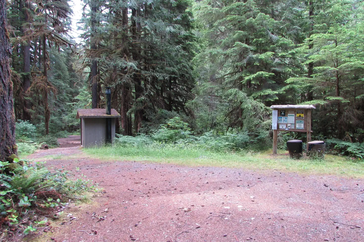
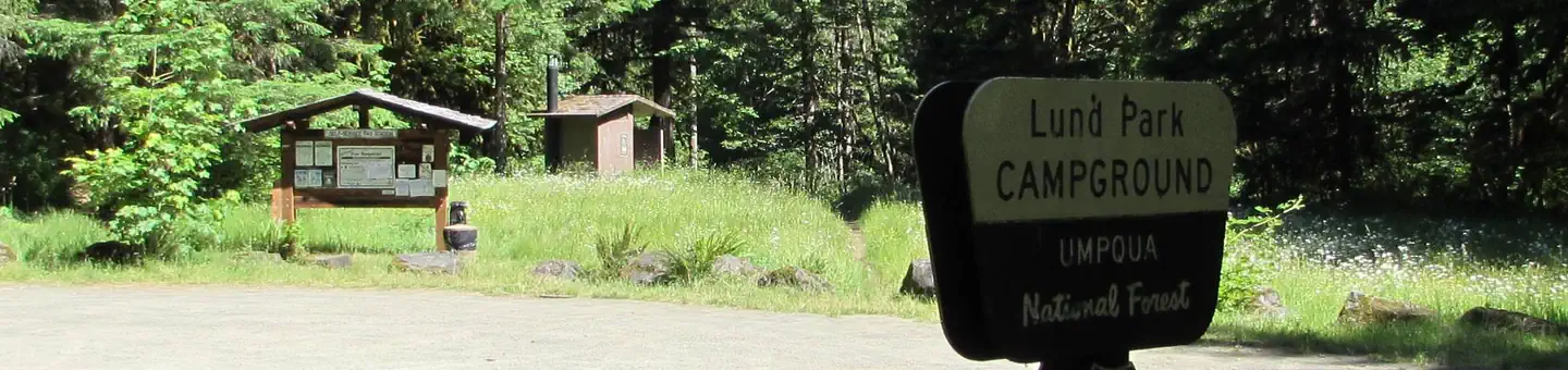
Lund Park Campground facilities include picnic tables, fire rings, two vault toilets, and garbage disposal. There is no running water or RV hookups available.
Lund Park Campground has a small parking lot on the west end for day use or additional campsite parking. Additional vehicles cost an extra $5 per night.
Each campsite includes one parking space, a picnic table, and a fire ring with an attached grill. There are two vault toilets on either end of the campground and several garbage cans along the main road.
Natural Features
Brice Creek runs along the north side of the campground and can be accessed by many trails. The creek’s numerous small waterfalls and pools make it a popular place to picnic and sunbathe on a hot summer afternoon, while old-growth forests, rocky shores, and mossy
Location
Lund Park Campground•OR
Weather Forecast
via Open-MeteoNearby Campsites
 3.1 km away
OR
Cedar Creek Campground
Campground: Cedar Creek Campground. Operated by Umpqua National Forest Service.
 3.3 km away
OR
Crawfish Lake Shelter
Campground: Crawfish Lake Shelter.
 8.0 km away
OR
RUJADA DAY USE PICNIC AREA
Overview Rujada Day Use Picnic Area is set along the banks of Layng Creek, with a large, open grassy area amidst a scattering of Douglas fir. Rujada is a perfect setting for family reunions, parties or group getaways. Recreation In addition to being a prime location for hiking and biking in summer and early fall. The large grassy field is perfect for group activities or sports, and a playground and horseshoe pit are also provided on-site. Hikers will enjoy a moderately challenging hike on Swordfern Trail, leaving from the historic Civilian Conservation Corps Campground Register booth, located in the Rujada Picnic Area. The trail parallels the south side of Layng Creek, traveling through a stand of second growth Douglas fir and lush swordfern understory, then climbs to an abandoned logging road. Eventually it loops back to the Rujada Picnic area, or continues on the logging road and back into the camping loop. In autumn, visitors will be treated to the brilliant fall colors of the hardwood trees along Layng Creek. Facilities This day use area has two reservable picnic sites. Each site can accommodate up to 30 people, and groups of up to 60 may reserve both sites. The sites are equipped with picnic tables and grills. Flush toilets and drinking water are provided. Natural Features Visitors to Umpqua National Forest are often taken aback by the unique landscapes of southwestern Oregon. Explosive geologic events have shaped the distinctive landscape on the nearly 1 million-acre forest, and provide spectacular scenery as well as an abundance of natural and cultural resources. The translation of the word, "Umpqua," meaning "thundering waters," defines the area. High mountain lakes, heart-stopping rapids, peaceful ponds and thundering waterfalls, including the 272-foot Watson Falls on the North Umpqua Highway, provide plenty of pastimes for visitors. Diverse ecosystems support a wide range of habitat for wildlife common to the area. From eagles and owls, to salamanders and salmon, these species, along with many others, depend on surrounding undeveloped wilderness, clean streams and diverse forests to live. Nearby Attractions Nearby are three spectacular waterfall trails. Spirit Falls is a short 0.4-mile, more difficult hike to a 60’ waterfall. Moon Falls is an easy, 0.5-mile hike to a 125’ cascading waterfall. Pinard Falls is a 0.6-mile, more difficult hike to a 105’ waterfall. All three hikes are within 10 miles of the campground and can be done within a single day. Visitors enjoy taking a picnic lunch and eating at the base of Moon Falls at a picnic table made and installed by a modern day Conservation Corps crew. Contact Info For facility specific information, please call (760) 932-7092. Charges & Cancellations Reservation sites will be held until check out time (11am) the day following your arrival date. Sites must be occupied by the checkout time of that following day to hold a reservation or the site will be forfeited and released to other guests. Once your reservation start date has begun, neither the Recreation.gov Contact Center nor the Campground Manager will be able to modify your reservation.
 8.1 km away
OR
RUJADA CAMPGROUND
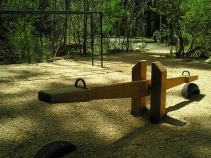
Overview Rujada Campground is located 21 miles east of Cottage Grove (45 minutes from Eugene) on a riverside terrace above Layng Creek. A favorite site for family picnics and camping, visitors will enjoy shaded campsites with privacy, access to swimming on the banks of Layng Creek and a hike through a rich riparian Douglas fir forest on the Swordfern trail. Check out a historic Civilian Conservation Corps (CCC) shelter and a kid's playground with obstacles, swing, teeter- totter and monkey bars both located within the campground. Recreation Recreational opportunities are plentiful and include hiking, biking, fishing, swimming, and nature viewing. Spirit Falls, Moon Falls, and Pinard Falls Trails are just a few of the local waterfall trails in the area. Facilities This developed campground offers toilets, picnic tables, campfire rings. A campground host is typically onsite during the summer season. There are 15 sites available at this campground. There is no water available at this campground. If there are any questions or concerns when the Host is unavailable, please feel free to contact Westrek Services at 760-932-7092 or [email protected]. If there are any questions regarding reservations, please contact Recreation.gov by going online or calling 877-444-6777. Natural Features This beautiful and quiet campground located in the Umpqua National Forest sits at approximately 1,200 feet in elevation among Douglas fir, hardwood trees and ferns. Contact Info For facility specific information, please call (760) 932-7092. Nearby Attractions Rujada Day Use Picnic Area is located within the campground and may be reserved. Nearby are three spectacular waterfall trails. Spirit Falls is a short 0.4 mile, more difficult hike to a 60' waterfall. Moon Falls is an easy, 0.5 mile hike to a 125' cascading waterfall. Pinard Falls is a 0.6 mile, more difficult hike to a 105' waterfall. All three hikes are within 10 miles of the campground and can be done within a single day. Charges & Cancellations Reservation sites will be held until check out time (11am) the day following your arrival date. Sites must be occupied by the checkout time of that following day to hold a reservation or the site will be forfeited and released to other guests. Once your reservation start date has begun, neither the Recreation.gov Contact Center nor the Campground Manager will be able to modify your reservation.
 8.3 km away
OR
MUSICK GUARD STATION
Overview Musick Guard Station is located in a remote setting in southwestern Oregon, offering visitors a glimpse into a historic mining community in Umpqua National Forest. Situated atop a narrow forested ridge between Fairview Peak and Grouse Mountain, the guard station and outbuildings were constructed by the Civilian Conservation Corps in 1934 to provide fire protection to the Bohemia Mining district. Listed on the National Register of Historic Places, Musick Guard Station became an important public contact point and administrative center for the Forest Service. Later it was used as summer barracks for trail crews and firefighting crews. The Guard Station was named after the nearby Musick Mine, a major gold producing mine in the late 1800s and early 1900s. Today the guard station continues to offer visitors a unique lodging experience and plenty of opportunities for relaxation and recreation. This site is located in National Forest System lands. These sites are popular with the recreating public so you may find visitors interested in the area and the facilities. While you do not have to let them inside the facility they are allowed to be in the area. Recreation For hiking and sightseeing, the nearby Bohemia Mountain Trail leads up a steep grade to the rocky summit of Bohemia Mountain, the highest point on the Cottage Grove Ranger District. Just east of the summit along a ridgeline hikers will be treated to dramatic views of the Cascade mountains and a wildflowers blooming along rocky outcrops and bluffs in late June through early August. For history buffs and fortune seekers, Musick Mine, one of the most productive gold mines in the district during the late 1800s and into the early 1900s, is a point of interest not to be overlooked. The area is named after James "Bohemia" Johnson, a mountaineer and prospector, who discovered gold-bearing quartz in 1863. The discovery created much short-lived excitement in the valley, but settlers soon realized the gold had to be extracted from the rock by machinery, not panned from the many streambeds, and by 1910 most of the ore had been removed. Some mining continues today. Facilities The main floor of the two-story guard station features a central room with an adjoining kitchen and bedroom. The upstairs bunkroom provides additional sleeping quarters. It is furnished with two double wooden platform beds and four bunk beds without mattresses, a table with chairs, a wood stove for heat, and wood cook stove and oven. Outside, a picnic table, campfire ring, and vault toilet are provided. An area for pitching a tent is also on site. There is no refrigerator, water or electricity available at the site. Guests must bring water necessary for drinking, cooking and washing. Guests must also bring a lantern or other reliable light source, cooking utensils, sleeping bags, sleeping pads, towels, dish soap, matches, cooking gear, toilet paper, first aid kit and garbage bags. Firewood may be available, however the supply cannot be guaranteed, and guests are encouraged to bring their own. Natural Features Musick Guard Station is surrounded by rugged summits up to 6,000 feet in elevation, and steep, heavily forested slopes of fir, spruce and hemlock. Nearby Fairview Peak, located in the heart of the Bohemia Mining District at an elevation of 5,933 feet, provides an excellent panoramic view of the surrounding area. On a clear day, the Cascade Range peaks can be viewed from Mt. Hood to the north and Mount McLoughlin to the south. Large mammals such as elk, deer, black bear, and cougar, as well as the smaller residents like squirrels, fox, raccoons and bats, are supported by the area's diverse forest habitats. Learn more about bear safety. Nearby Attractions Visitors may want to take some time to
 Britz HiTopCampervan
 Maui UltimaCampervan
 Jucy CoasterCampervan
Hitting the road? Rent the rig, not just the gear.
Compare live prices across Britz, Maui, Apollo, Jucy & more — campervans and motorhomes, one-way hires included.
Compare & bookPlan your visit
Save it, check the weather, map your route
Nearby Fuel
Campsite Explorer
Find Your Next Campsite
Share Your Experience
Help fellow campers by sharing your photos and reviews.
Own This Campsite?
Claim your listing to manage information, respond to reviews, and update details.
Lund Park Campground